Thanks to technology and my GPS device, here are some interesting ways of looking at my hot air balloon flight. Click each image for a larger, more legible version.
The flight path, color-coded by elevation segments, superimposed on a street map (though the area didn't have many street names):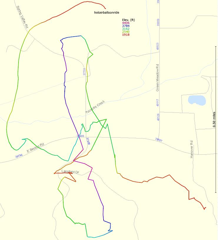 |
The flight path superimposed on a black and white USGS satellite aerial photograph of the area: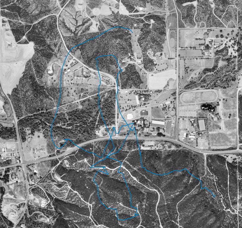 |
The flight path, color-coded by elevation, superimposed on a color satellite aerial photograph, showing some street names: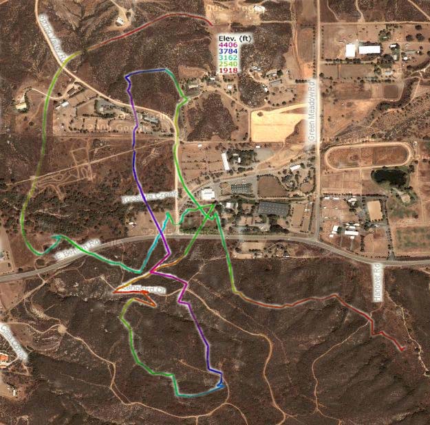 |
Aerial view of the meeting place and location of the champagne brunch afterwards (Wilson Creek Winery) in relation to the general flight area. The Winery is at the lower left and the flight area at the upper right.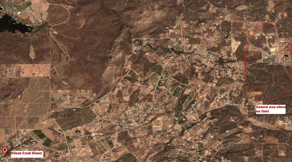 |
(Click here go back to main balloon start page.)